Woodlawn Lake Listing Specialist · Local guide
Woodlawn Lake & Monticello Park
This is the neighborhood I chose for my own home. Use this guide to get to know Woodlawn Lake and Monticello Park, then look more closely at the streets, homes, and property details that shape your next move.
For Woodlawn Lake and Monticello Park homeowners
Before you spend money preparing to sell, start with a plan.
I am a Monticello Park homeowner and Woodlawn Lake listing specialist. My buyer-specific approach starts with your home's condition, competition and the reasons a buyer would choose it.
- Gather the property records. Bring together your survey, permits, major-system service records and documented improvements.
- Separate condition from cosmetics. Identify questions that need a qualified professional before deciding which presentation changes are worth considering.
- Compare the right homes. Review the property's layout, condition, location and current alternatives, rather than relying on a neighborhood-wide average.
- Market the reasons to choose it. Build the photography, property website and distribution around the home's strongest documented features.
Orientation
Start with the roads that organize the area.
Josephine Tobin Drive wraps the immediate Woodlawn Lake Park setting and is one of the clearest local reference points around the lake. W. Woodlawn Avenue connects the park area east and west, while Fredericksburg Road forms an important diagonal corridor along the Monticello Park side of the area.
N. Zarzamora Street provides a north-south reference west of the park, while Culebra Road and nearby I-10 help connect the area toward Downtown and the larger city network. The result is a neighborhood-scale street grid with several larger corridors close by rather than one single access route.
Central-city access
Compare routes to Downtown and Pearl.
Woodlawn Lake sits only a few miles northwest of Downtown San Antonio. Pearl is roughly a 10-minute drive in lighter traffic, with actual travel time changing by route, construction, events, and time of day.
That proximity is useful as a geographic reference: Woodlawn Lake feels distinctly residential and park-centered while still sitting close to Downtown, Five Points, the Fredericksburg Road corridor, and the inner-city street network.
Visual orientation
Woodlawn Lake with the San Antonio skyline beyond it.
This original Brick & Bearing sunrise panorama puts the lake, surrounding parkland, nearby residential fabric, and the San Antonio skyline in the same frame. The skyline is useful visual context for the area's relationship to the central city, while official maps remain the source for neighborhood and district boundaries.
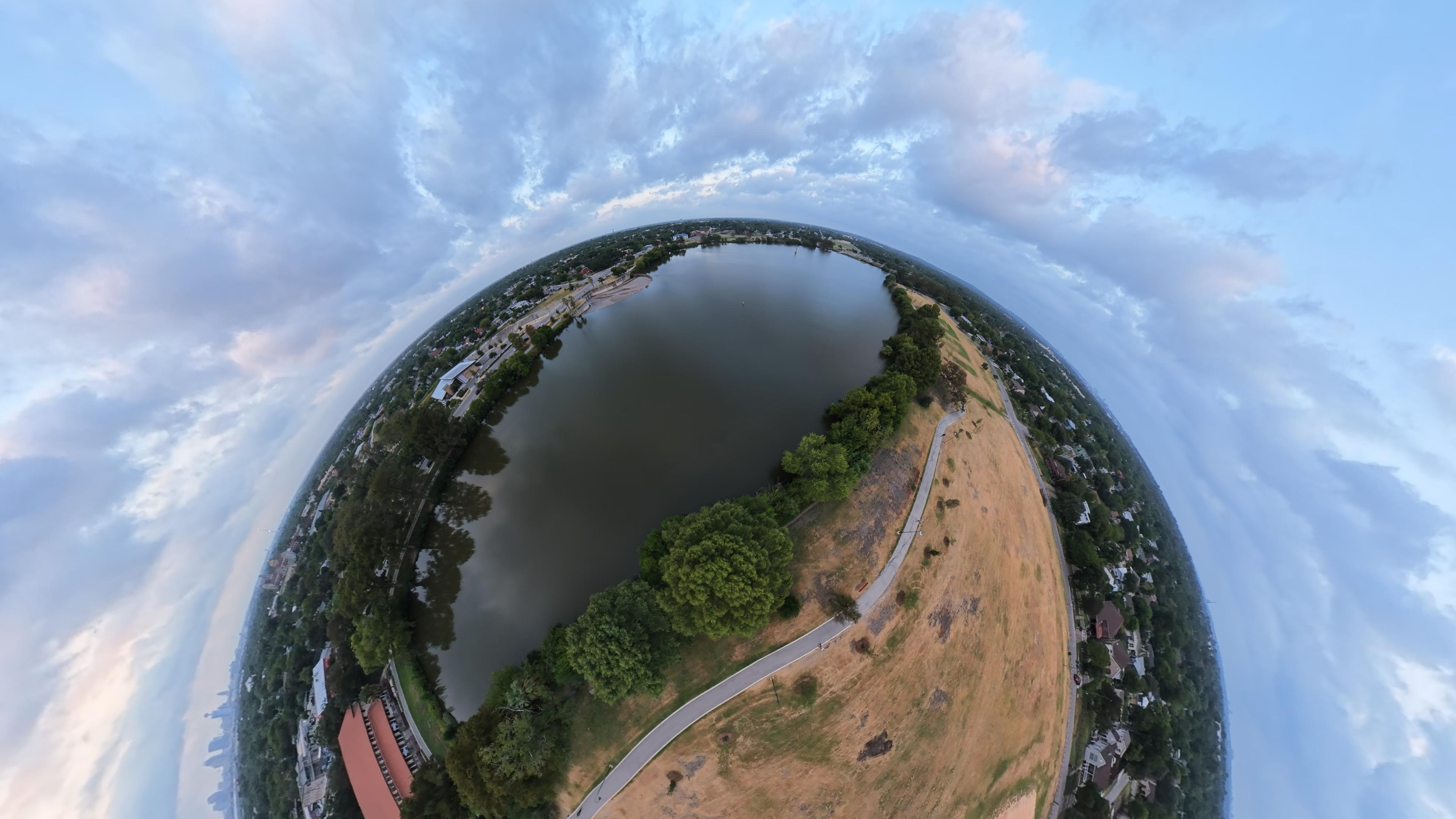
Woodlawn Lake Park
The park is the physical anchor.
The City of San Antonio describes Woodlawn Lake Park as a 62-acre public park with a lake of about 30 acres. The lake began in the 1880s as West End Lake, created when Alazán Creek was dammed as part of an early residential development. The lake and surrounding land were deeded to the City in 1918 and later became Woodlawn Lake.
Today the park includes walking and bicycle facilities, fishing, a swimming pool, tennis courts, community facilities, public art, playgrounds, and open gathering areas. Because the park is used citywide as well as locally, it functions as both neighborhood infrastructure and a recognizable San Antonio landmark.
Monticello Park
An official historic district immediately tied to the lake.
Monticello Park is a City-recognized residential historic district directly north of Woodlawn Lake. The City's historic-resources guide identifies an entrance feature at W. Woodlawn Avenue and Josephine Tobin Drive and notes Fredericksburg Road as a major boundary and commercial corridor.
The district's street pattern is mostly gridded, with changes in alignment near Fredericksburg Road. Its housing and architecture span multiple early- and mid-20th-century styles, and the City specifically documents examples ranging from Art Moderne to Spanish and Mediterranean-influenced design.
Historic designation can affect exterior work and design review. When that status matters for a specific address, the City's official historic map and Office of Historic Preservation should be checked directly rather than inferred from a neighborhood name.
Jefferson & Woodlawn Place
A distinct neighborhood with its own history.
Jefferson is another important part of the Woodlawn Lake context, but it should not be treated as the same official district as Monticello Park. The City maintains a Jefferson Neighborhood Conservation District, while the Woodlawn Lake area also has its own Neighborhood Conservation District standards.
The City's Near Northwest Community Plan notes that the historic Woodlawn Place development began in 1921 in what is now the southeast corner of the Jefferson neighborhood. The plan describes that original development as bounded by Fredericksburg Road to the east, W. Kings Highway to the north, Zarzamora to the west, and Woodlawn to the south.
Woodlawn Lake, Jefferson, Monticello Park, and the surrounding street system overlap in everyday conversation, but they remain distinct places with different boundaries and rules.
Original local media
Woodlawn Lake at dawn.
This original Brick & Bearing aerial flyover provides first-party visual context for the lake, park, surrounding street pattern, and nearby residential fabric.
Built environment
Historic fabric, varied topography, and block-by-block differences.
Much of the surrounding area reflects early- and mid-20th-century residential development: detached homes, established street grids, mature setbacks, detached garages, and architecture that changes from one subdivision or district to the next.
Topography also changes across the area. City historic documentation describes western Monticello Park as hillier while the eastern portion is generally flatter. Renovations, additions, drainage, foundations, historic overlays, conservation-district standards, and lot configuration can therefore vary meaningfully from block to block.
Official references
Use the responsible source when a boundary or rule matters.
For homeowners considering a sale
Turn the neighborhood research into a seller plan.
Continue exploring
Put the guide to work
Turn orientation into an address-specific check.
Choose an exact location, identify the roads you would use regularly and follow the official references below for boundaries and property details. Keep a note of the source and date so observations and changing conditions stay separate.
W. Mulberry homeowner briefing
Follow the changes on our own streets.
Follow the W. Mulberry sidewalk project through original video, neighborhood observations, and the questions homeowners are asking about local improvements.
Visit the W. Mulberry project ↗Your next move
Put the local context to work.
Thinking about selling around Woodlawn Lake or Monticello Park? Let’s connect your home’s character, your timing, and your next move to a thoughtful listing plan.
Start a conversation